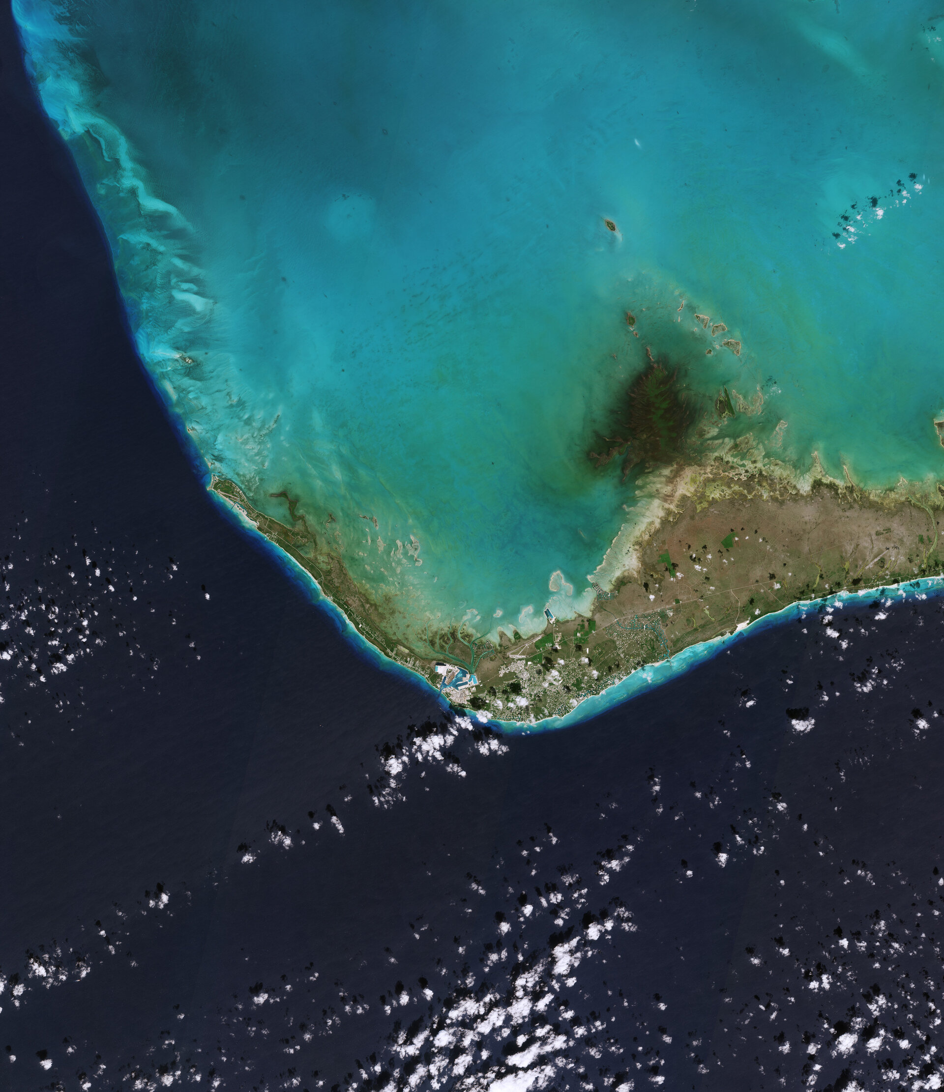
Ahead of World Ocean Day, the Copernicus Sentinel-2 mission takes us over the west of Grand Bahama Island, in the Bahamas.
Zoom in to explore this image at its full 10 m resolution or click on the circles to learn more.
Located in the Atlantic Ocean about 100 km east of the US state of Florida, Grand Bahama is the northernmost island in the Bahamas and the third largest in the archipelago. Grand Bahama’s two main cities are both visible in the image: West End on the northwestern tip of the island and Freeport on the southern shore.
West End is the oldest city on the island, and the capital. The runway of West End airport, the smaller of the two airports serving Grand Bahama, can be spotted west of the city.
Freeport, which has been built on what was an area covered by pine forest a little over three decades ago, is now a thriving port, industrial centre and tourist destination. It is now also the second most populous city in The Bahamas. Zooming in, the Grand Bahama International Airport is visible north of the city, while the port, the second-largest cruise port in The Bahamas, stands out to the west.
The shallow, turquoise waters surrounding the island contrast sharply with the deep blue of the open ocean, which dominates the bottom part of the image.
Taking place on 8 June each year, World Ocean Day is an opportunity to celebrate the ocean – its abundant life, its importance and how we can protect and restore its resources.
Click here to view original web page at Earth from Space: Grand Bahama Island